18
FOR SUPPLEMENTAL INFORMATION CALL 1-800-845-3524
8
PUBLISHED RESERVE:
$99,500
LAST ASKING:
First Time Offered
SIZE:
146± Acres
ELEVATION:
2,400 to 2,600± Feet
ZONING:
TR – Timberland Resource
PROPERTY INSPECTION:
At Any Time
FINANCING:
None – All Cash
DESCRIPTION:
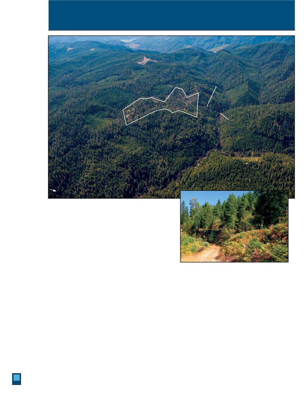
This 146± acre timber tract is located 10± miles north of the South Umpqua Riverfront
community of Tiller, and is a private in-holding within Bureau of Land Management ownership. There is BLM
Road 34 access into the northeast corner of the property from Deadman Creek Road.
The property consists of two patented mining claims, Umpqua and Maude-S mines, and has an irregular shape.
The processing operations for both mines was conducted off-site on land owned by the BLM, and operations
ceased in the early 1940s. Please see Supplemental Information Package for report on the abandoned mine
program.
The bulk of the property was harvested and then replanted by the Seller 16 year ago. There is an estimated 300±
MBF of primarily residual Douglas-fir on the property.
Stanley Creek Bisects the southwest section of the property. There are logging roads that access the property,
which has primarily moderate northwest-facing slopes. The Douglas-fir site index is II.
LOCATION:
Township 29 South, Range 2 West, Sections 34 and 27, Tax lot 2900.
Stanley Creek Timber Tract, near Tiller
Douglas, County, Oregon
BLM Rd. 34-0
Deadman
Creek Rd.
N


